HF Houses - Longmynd Hotel, Church Stretton
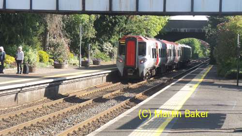
Church Stretton is very good for traveling by train and there are lots of walks from the house. So 7-night self-guided without a car is a good option if you like some uphill walking.
Trains go to Church Stretton from Cardiff and Newport from the south. From the north trains come from Shrewsbury, Manchester and Holyhead.
From London, many routes are possible but I usually go via Newport. Unfortunately when I get to Newport, late morning, there seems to be a 2 hour gap between trains. Then when the train gets in from Cardiff it is already quite full and there are a lot of people waiting at Newport to get on. So I sometimes have to stand for the first few stations. People get out at most stations and by Abergavenny there is usually more space.
Longmynd Hotel is not too far to walk from the railway station for most people. There aren't any taxi companies based in Church Stretton so, if you need a taxi you will need to pre-book one to come from Shrewsbury which makes it expensive.
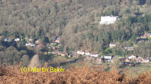
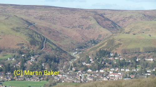
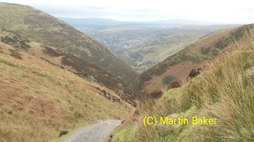
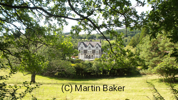
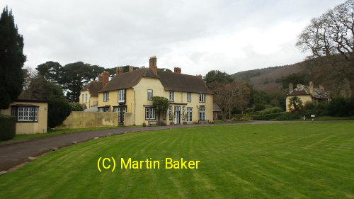
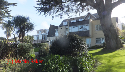
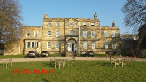
As you can see from the picture below Longmynd Hotel is higher than than the village so there is some uphill involved.
Getting to Longmynd Hotel by Public Transport
I have put pictures and information about getting to Longmynd Hotel by public transport on the page here.
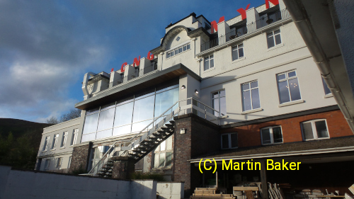
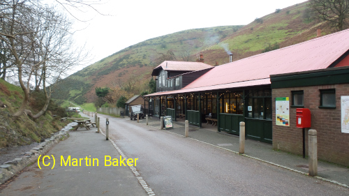
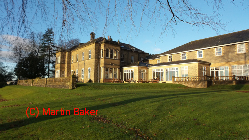
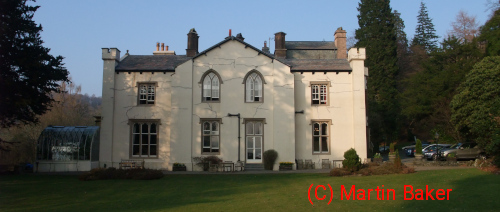
Longmynd Hotel
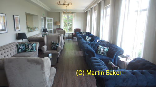
I have put pictures and information about the house and garden on the page here.
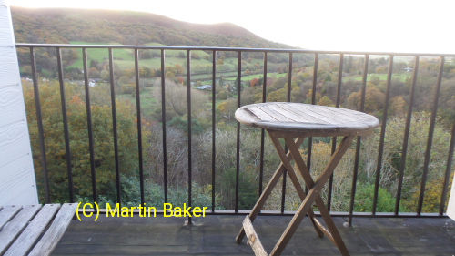
Some of the rooms on the top floor have a small balcony. When I first went to Church Stretton these were very rusty and looked unsafe, after the refurbishment they look a lot better.
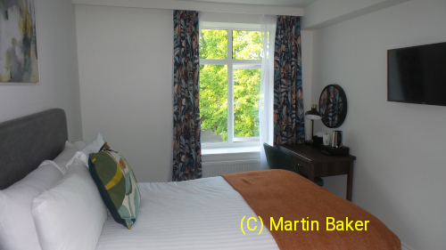
On the other side of the hotel the rooms don't have such a view, just facing the drive.
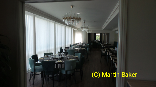
The dining room has big windows that look out toward Ragleth Hill, there are mirrors on the opposite wall so those facing in also have a view. The dining room does feel a bit like a corridor though and the acoustics are terrible. The big windows an mirrors reflect the sound and there is little to deaden it, this makes it hard to hear across the table. Most HF dining rooms have bad acoustics and I would have thought HF would have learned from this and taken the opportunity in the upgrade to improve things but instead they have made it worse.
The chairs here are nice and heavy so its difficult to move them.
I have put pictures and information about the house and garden on the page here.
Walking From the House With Public Transport
There are lots of good walks from the house, most of them involve some uphill.
- Caer Caradoc
- Long Mynd
- Lawley
- Ragleth
- Hope Bowdler
- Stiperstones
- Midland Gliding Club
- Stokesay
- Ludlow
- Shrewsbury
The Long Mynd
The Long Mynd is a heath and moorland plateau that forms part of the Shropshire Hills. There are many routes up and down from the plateau and each one has a different character so you can go up the Long Mynd on several days and each one will be different.
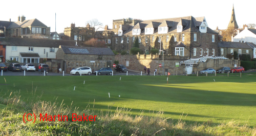
Carding Mill Valley is in the middle of the picture above and the road winds its way to the top on the left. The road is only wide enough for one vehicle with passing places so, if you meet something coming the other way you may have to reverse on a steep road. I would not advise driving up it (much better to leave your car at home).
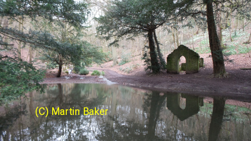
Carding Mill Valley has a big car park and its very busy, lots of school parties with measuring equipment doing geography lessons. So I would not recommend it except if the weather is really bad and you need some shelter to eat your lunch.
There are several routes to the top from Carding Mill, one of them involves scrambling up a rock near a waterfall.
Getting between Carding Mill Valley and Longmynd Hotel involves some up and down (or some down and up) as there doesn't seem to be a way to contour round above Church Stretton. I usually end up getting lost so factor this into your walk planning.
(I have put a page about these walks here)
A nice scenic route up Long Mynd is Ashes Hollow:
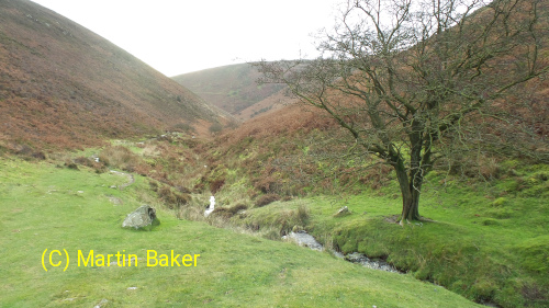
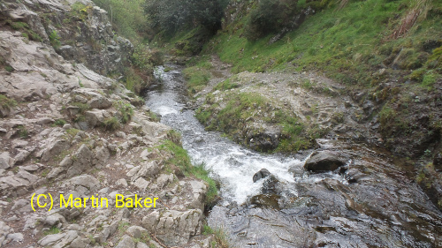
The path does cross the stream in various places. So if there has been a lot of rainfall this could get a bit tricky.
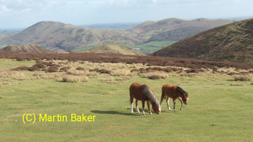
At the top of Long Mynd there is a flat plateau with heather crossed by grass paths.
There are some wild horses on the more remote parts.
When you go down, make sure you get the path you want, they are marked by small wooden signs but they can be difficult to read.
The valley down from Long Mynd which is closest to Longmynd Hotel is Town Brook.
(I have put a page about these walks here)
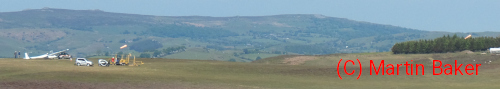
Midland Gliding Club
There are much more routes up Long Mynd, for instance by the golf course or to the gliding club (I have put a page about this walk here).
Hiking Bus
In summer (May - September) a hiking bus runs which gives a chance to walk up Long Mynd from the other side.
Caer Caradoc
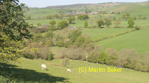
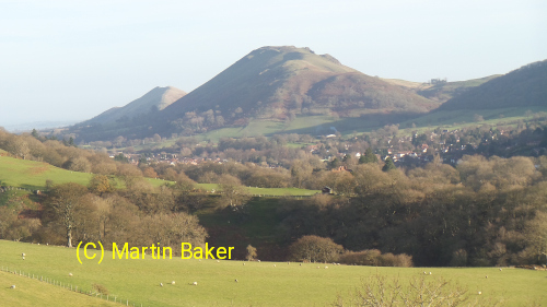
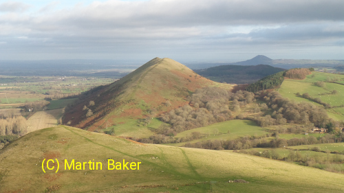
On the other side of Church Stretton there are various hills within walking distance and worth exploring such as Caer Caradoc, The Lawley, Ragleth Hill and Hope Bowdler.
I have put a page about this walk here.
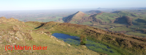
The summit has an Iron Age or late Bronze Age hill fort.
The Lawley
You can walk here from the house or, to make the walk shorter, catch the bus toward Shrewsbury as far as Longnor.
I have put a page about this walk here.
Stiperstones
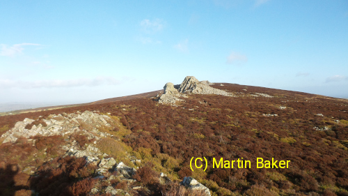
In summer (May - September) a hiking bus runs which gives a chance to visit the Stiperstones.
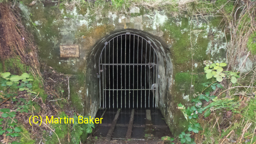
Entrance to the Somme tunnel at the abandoned Bog Mine. It was started in 1916, during World War I, and is named after the Battle of the Somme. The primary reason for its creation is believed to have been to provide employment for local miners to prevent them from being conscripted to fight.
I have put a page about this walk here.
Other Walks from Longmynd Hotel
- Caer Caradoc
- Long Mynd
- Lawley
- Ragleth
- Hope Bowdler
- Stiperstones
- Midland Gliding Club
- Stokesay
- Ludlow
- Shrewsbury
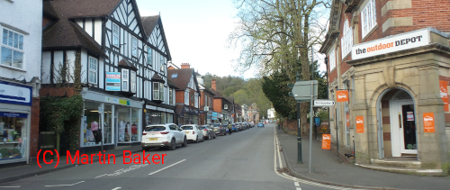
Shops in Church Stretton
If you forget to bring anything I have put a page about some shops in Church Stretton .
Other Documents on this site
Click on the following for more information

| Former HF Houses | |
|---|---|
| Conwy (1914- 2011) |  |
| Newlands (1914- 1987) | 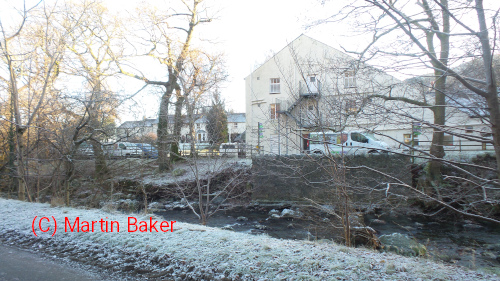 |
| Swanage (1947- 1995) | 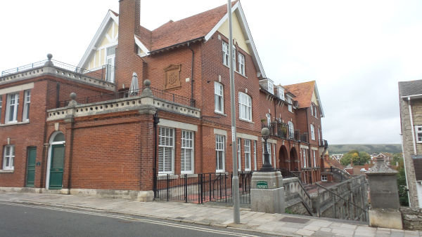 |
| Isle of Arran (1925- ) | 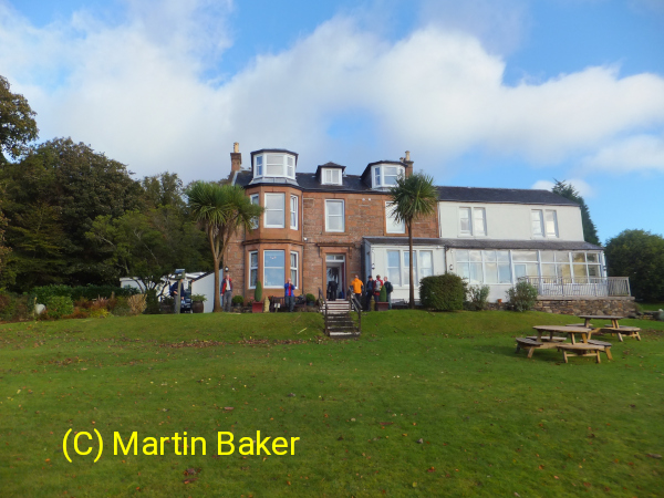 |
| Scarborough (1954- 1998) | 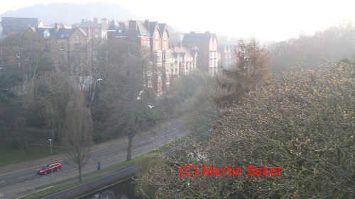 |
| Lulworth | 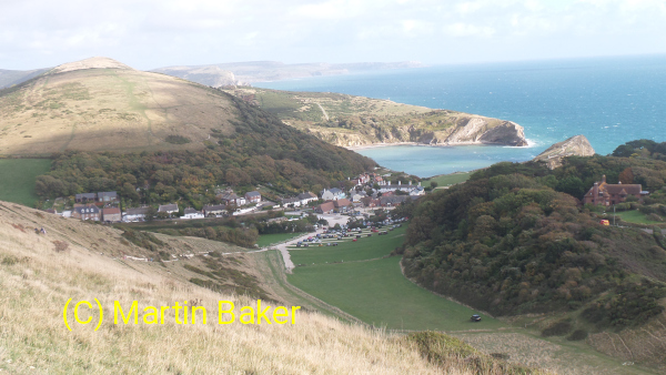 |
| Beddgelert | 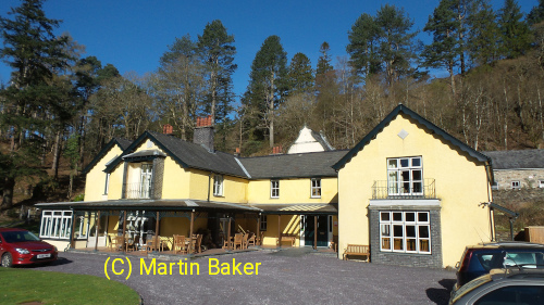 |
| New Inns |  |
| Penrith |  |
| Milford-on-Sea | 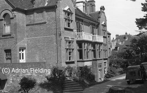 |
About This SiteHere is some information I have gathered together about getting to and walking from HF houses when leaving the car at home. On these pages I have also put some history about former HF houses I have visited. The information here is based on my visits to HF houses over the years. It may be out of date so don't rely on anything here without checking. If you find any errors why not let others know by putting a post on the HF Holiday Fans ( unofficial) Facebook forum. I will try to quote such posts here so they don't get lost. This is information I have discovered over the years which would have been useful to know before. Unfortunately the travel information on the HF website, for getting to houses by public transport, is poor. I think it would be better if the information on this page were on the HF website. |
| Web page design and content © 2025 M J Baker.. |